Project Highlights
- 2023 VTEMtm Plus completed – 1,374 line-kms
- Coyote Target Area
- Hosts interpreted structural trends occurring sub-parallel to the Patterson Lake trend
- Untested – No drilling has occurred on the project
- The estimated thickness of the Athabasca Sandstone is 220 to 560 metres
Overview
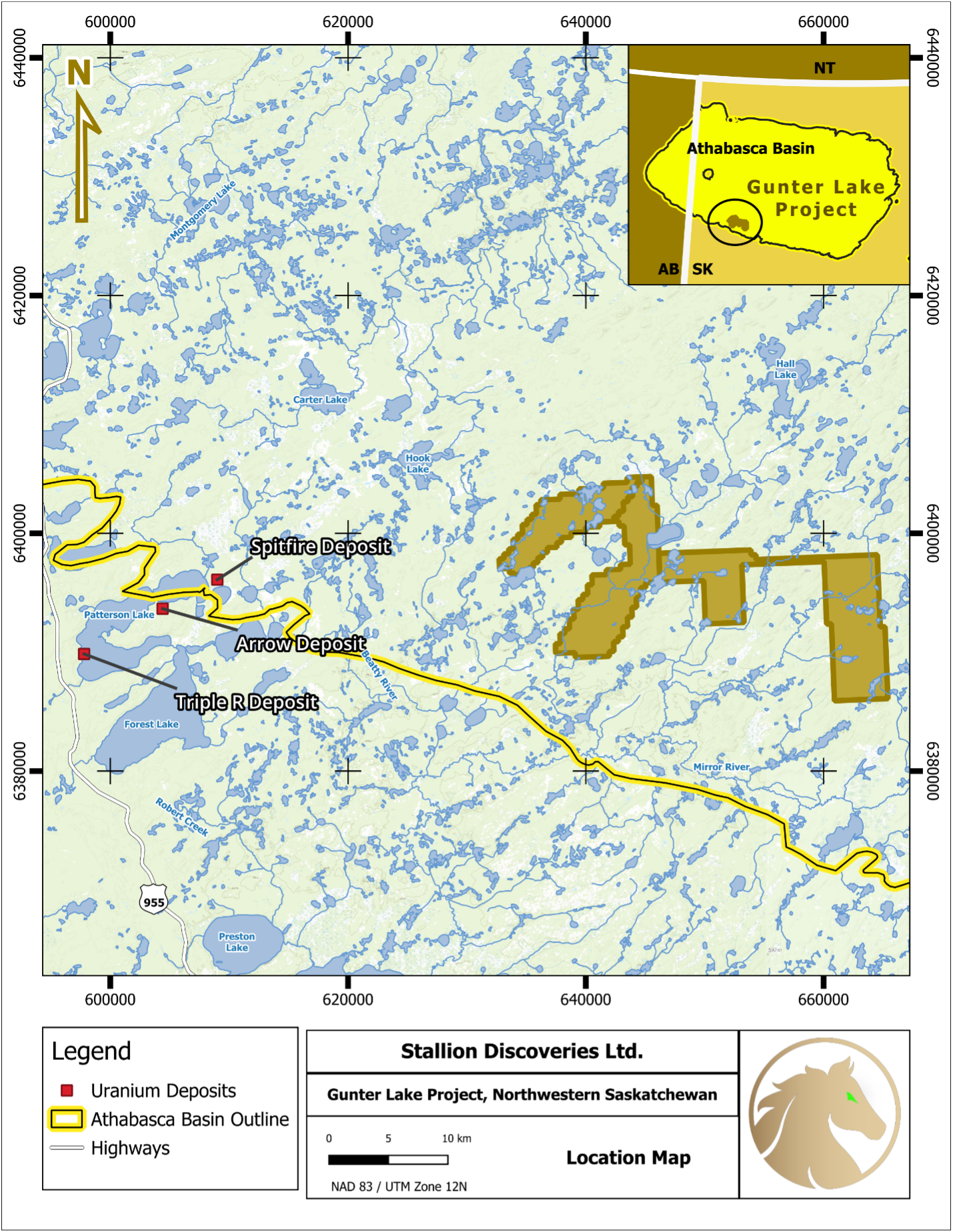
The 100% owned Gunter Lake Property consists of four adjoining claims with a total area of 17,769 hectares situated in the heart of the Patterson Lake uranium district in the southwestern Athabasca Basin, approximately 30 km east of NexGen Energy’s Arrow Deposit (256.7 million lb. of U3O8 combined measured and indicated).
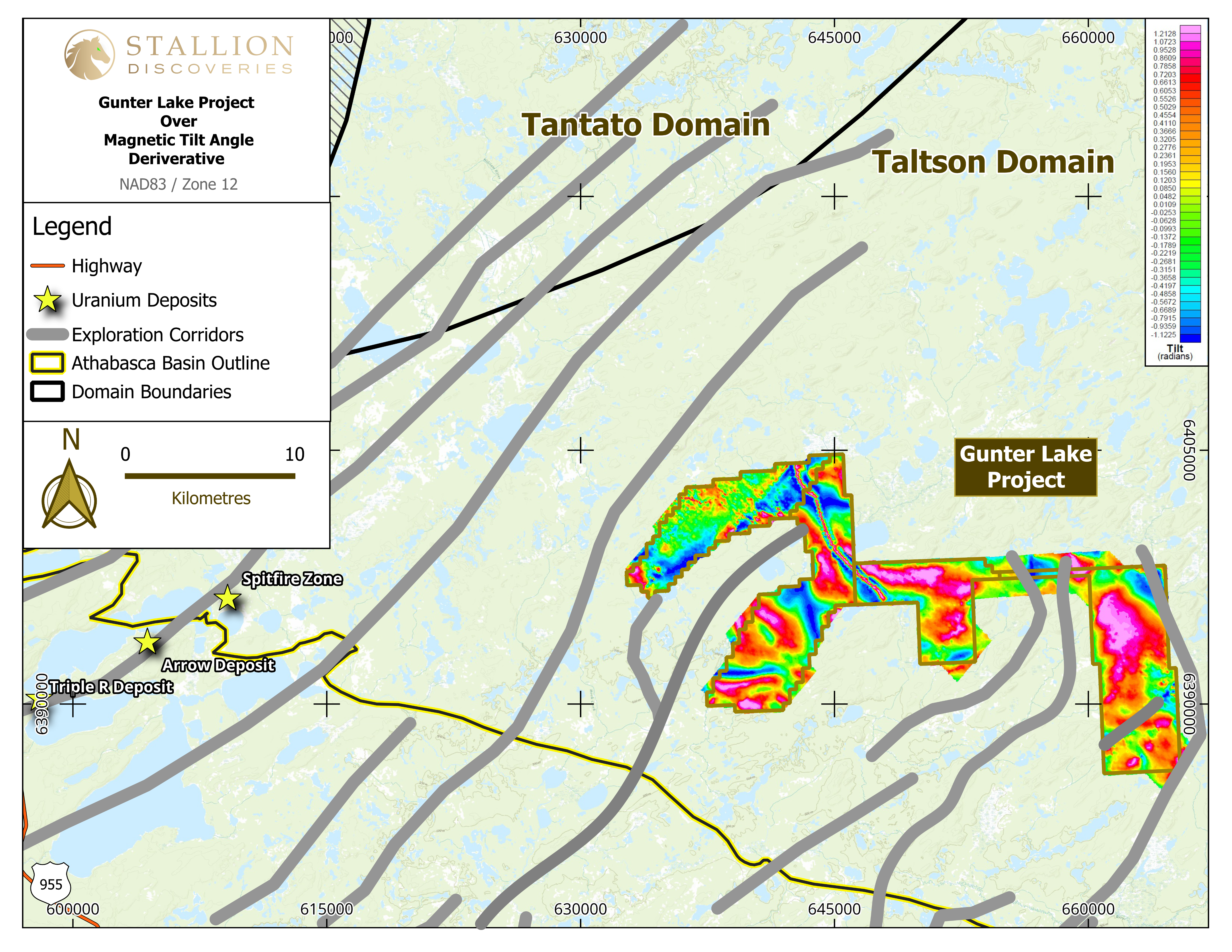
A VTEMTM plus was completed on the property in winter 2023 to cover the entirety of the property. The company worked with Condor Consulting for advanced data processing. Preliminary data was released with the Magnetic Tilt map shown below in Figure 2.
Target Area
Coyote Target
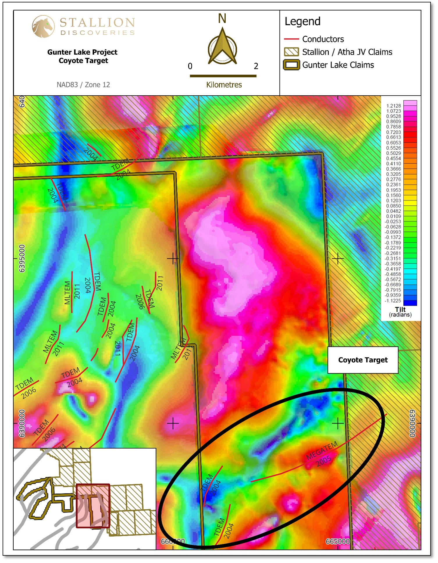
- Occurs on the most eastern block of the Gunter Lake project hosting one conductor, which has a ~5km of strike length
- The conductor occurs as an East-West trending anomaly cutting across the claim block
- The conductor continues east on the projects held by the Stallion / Atha Joint Venture

Exploration Plan
Phase 1
Completed a regional airborne VTEMtm Plus survey over the entire project.
Phase 2
A ground TDEM survey over the target area. The results will significantly increase the resolutions of the conductors, thus increasing the targeting probabilities of intersecting mineralization and alteration.
Phase 3
A 1,500m drill program. The drilling phase will commence once ground TDEM results have be completed and interpreted. The Company will be utilizing gamma probe and borehole EM testing of the drill holes for additional information.

Figure 1 - Gunter Lake Project Map

Figure 2- Magnetic Tilt with Exploration Corridors
